
Built by the Swiss drone enthusiast Jan Hiersemenzel, TravelByDrone is a new website that collects video footage taken from aerial drones on one easy-to-use Google Map. There are precious few restrictions on what can be uploaded to the site, according to its guidelines:
For a share request to be validated, the video needs to be taken by a drone (not of a drone), be of good quality and clearly show the area in which the drone flies. A video will not be accepted if it is taken indoors, is from a military drone or is of promotional nature (promoting a product or has a political, religious or other personal message).
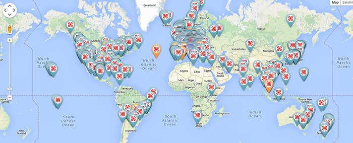
The result: A catalog of gorgeous footage of nature, cities, and everything in between. Each pin on the above map corresponds to aerial video footage taken by a drone. Simply click on a pin to see the footage. Zooming in on the map reveals dozens more pins, across the globe. It's both a fabulous way to organize all of the footage being uploaded by drone owners, and a testament to the wild proliferation of the flying devices in recent months.
Start with a few favorites:
Lava on Kilauea, Hawaii


View this video on YouTube
Iceland

View this video on YouTube
Serengeti, Tanzania

View this video on YouTube
Osaka, Japan
