
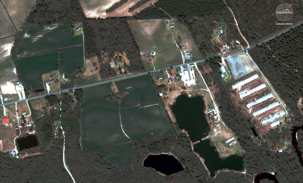
These before-and-after images show flooded farms in Wallace.

These before-and-after images show flooded farms in Wallace.
These before-and-after images show flooded farms in Wallace.
Hurricane Florence made landfall on North Carolina on Friday, Sept. 14, with 90 mph winds, ripping trees out of the ground, tearing roofs off buildings, and killing dozens of people.
At least 27 deaths have been attributed to the storm in North Carolina, while another nine people died in South Carolina and three died in Virginia.
As the storm crawled over land, it brought record rainfall and catastrophic flooding, which caused at least two hog waste lagoons in North Carolina to breach, while damaging others.
These before-and-after satellite images show the destruction of the area surrounding Wallace, North Carolina, which is about 35 miles northeast of Wilmington and is close to the Northeast Cape Fear River. Most of the before images are from April, while the recent images were all taken Thursday.
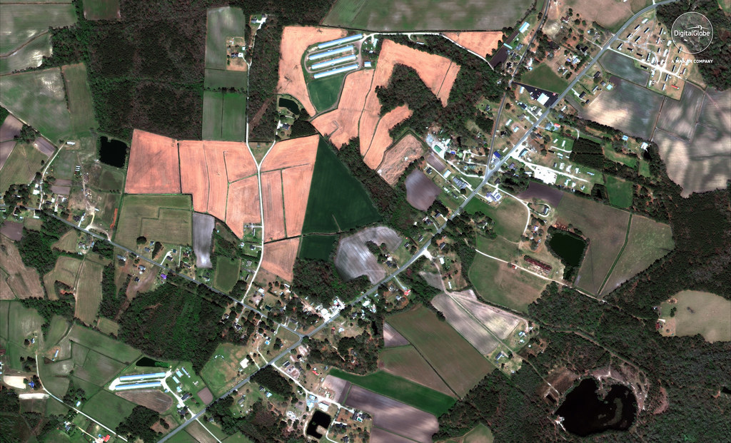
Homes, farms, and roads before and after Hurricane Florence hit Wallace.

Homes, farms, and roads before and after Hurricane Florence hit Wallace.
Homes, farms, and roads before and after Hurricane Florence hit Wallace.
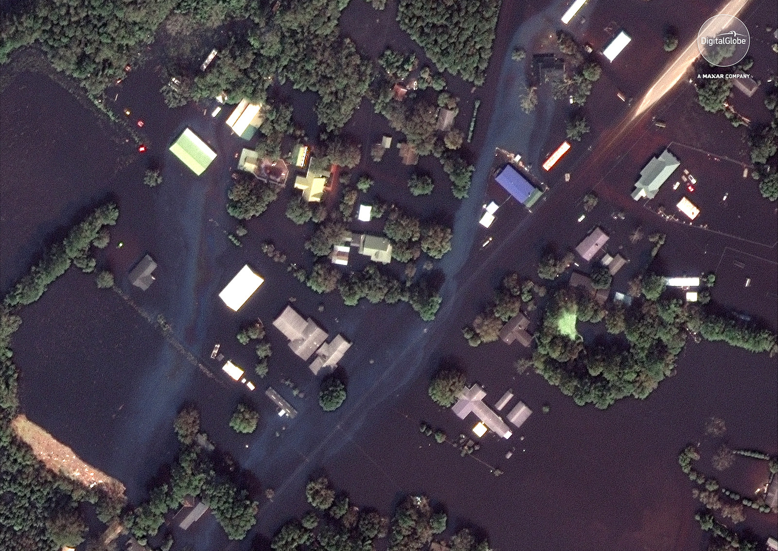
A residential community just northeast of Wallace is seen flooded.

A residential community just northeast of Wallace is seen flooded.
A residential community just northeast of Wallace is seen flooded.
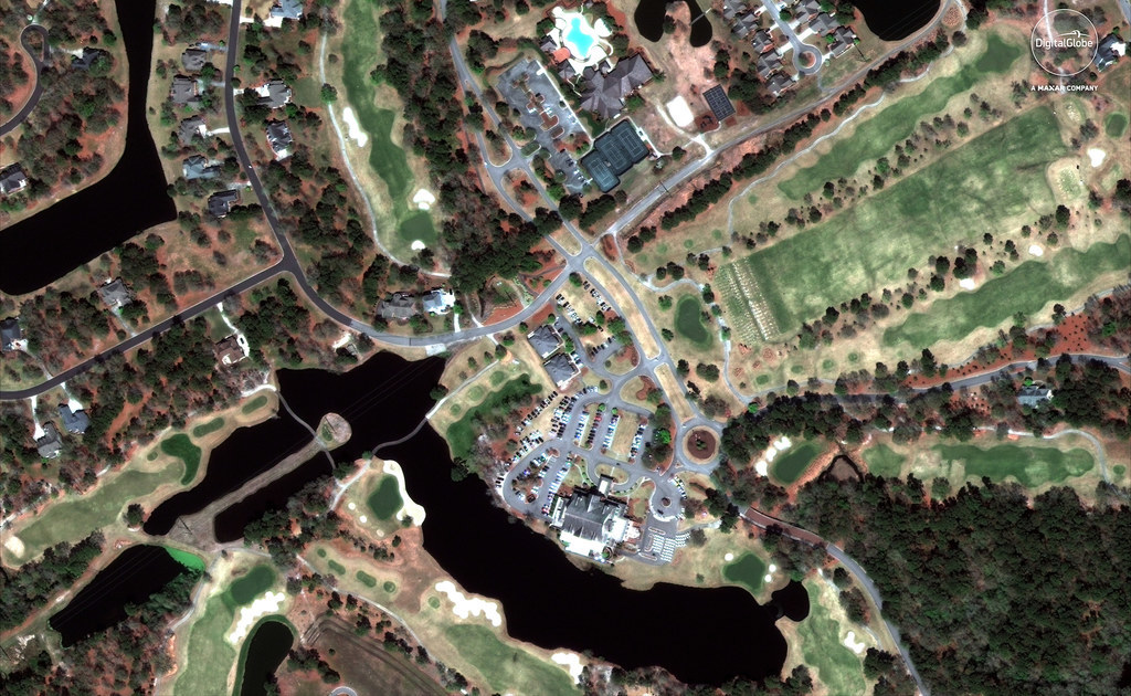
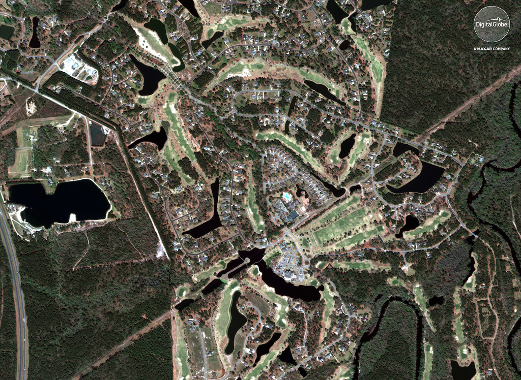
These images show the area around the River Landing Country Club in Wallace.

These images show the area around the River Landing Country Club in Wallace.
These images show the area around the River Landing Country Club in Wallace.
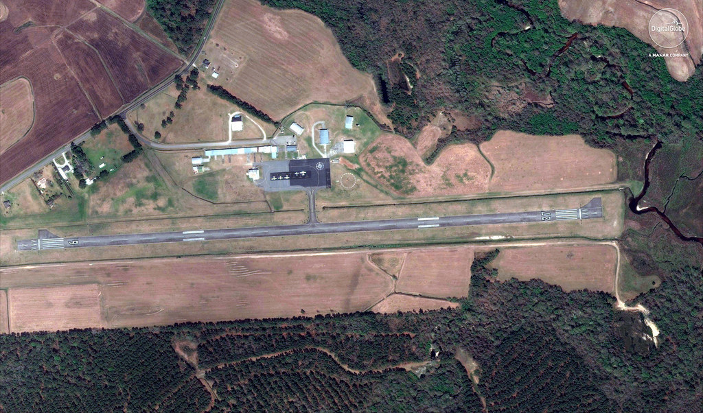
The Henderson Field Airport is seen partially submerged in water after Hurricane Florence.

The Henderson Field Airport is seen partially submerged in water after Hurricane Florence.
The Henderson Field Airport is seen partially submerged in water after Hurricane Florence.