These Before And After Pictures Show The Devastation In The Bahamas Caused By Hurricane Dorian

At least 30 people are dead and thousands of homes destroyed after Hurricane Dorian struck the Bahamas as a powerful Category 5 storm.

Hurricane Dorian made landfall Friday in Cape Hatteras, North Carolina, as a Category 1 storm with sustained winds of 90 mph. But earlier in the week, the slow-moving hurricane pummeled the Bahamas for nearly 48 hours as a Category 5 storm with sustained winds of 185 mph, leaving at least 30 dead and thousands of homes in ruins. Hurricane Dorian was recorded as the strongest storm to ever strike the Caribbean nation.

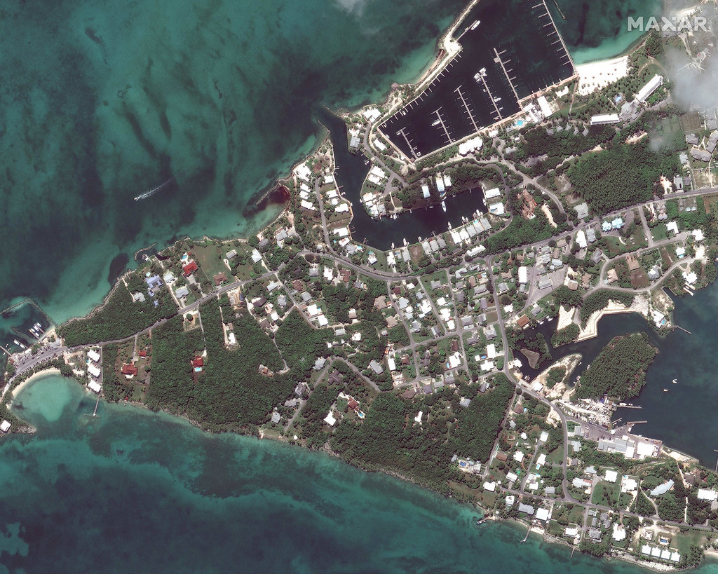
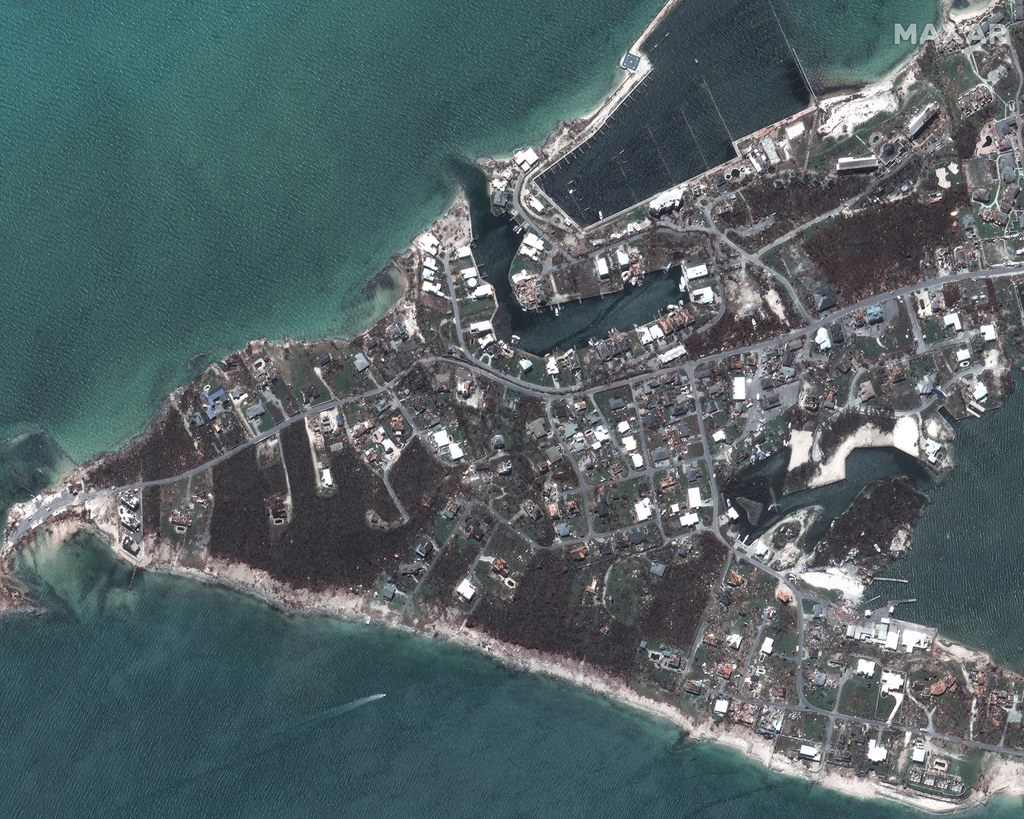
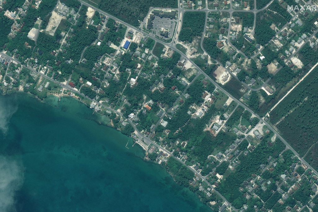
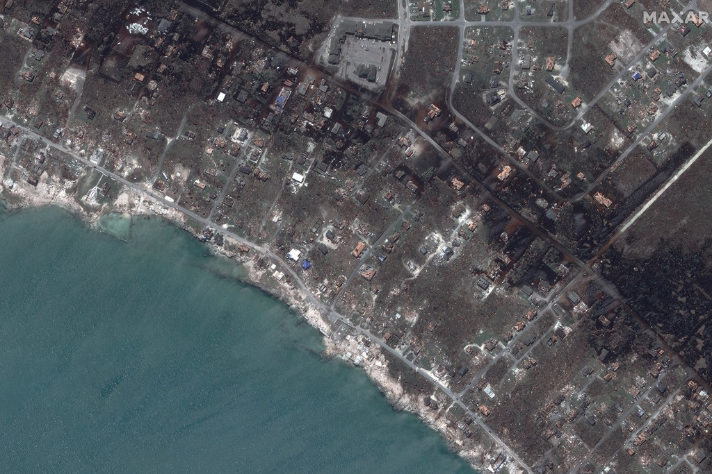
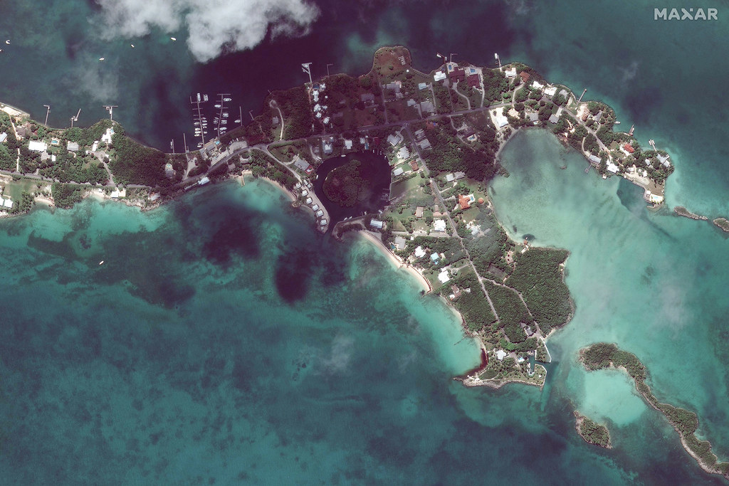
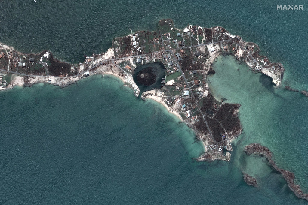
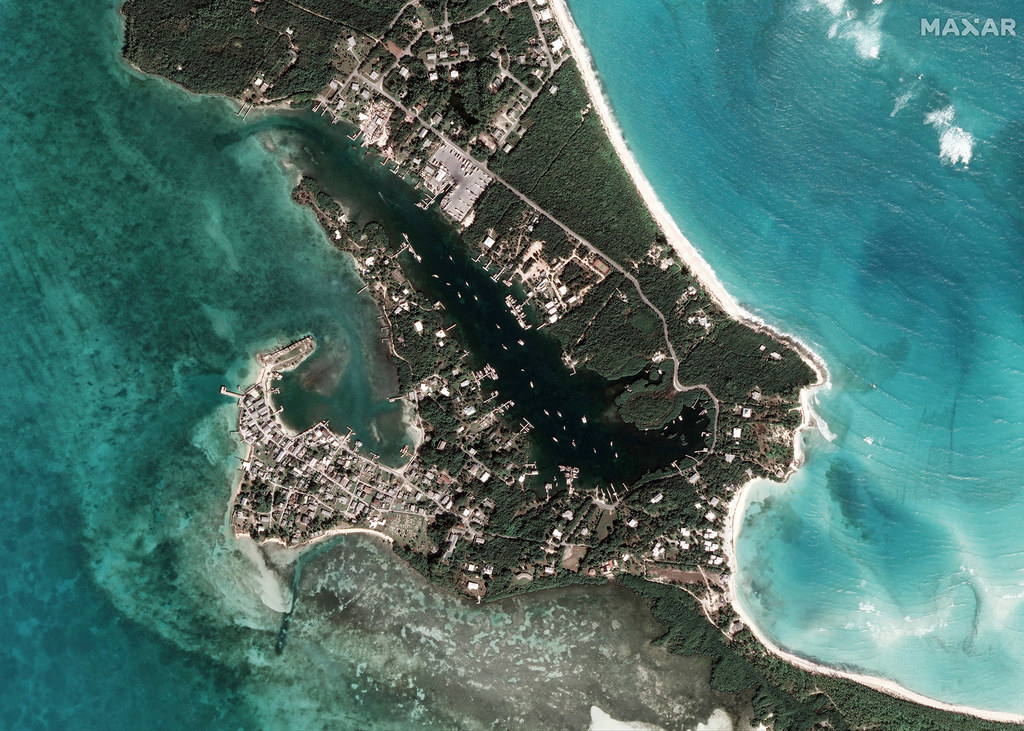
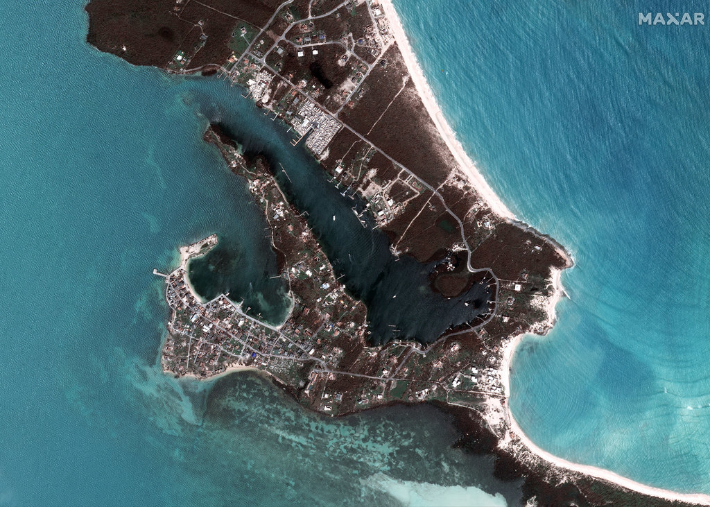
The Abaco Islands in the northern Bahamas received the brunt of Hurricane Dorian's wrath, leaving towns and islands such as Marsh Harbour, New Plymouth, and Green Turtle Cay virtually destroyed. These satellite images of the region, first captured on Oct. 25, 2018, then again after the impact of the storm on Sept. 5, capture the full extent of the devastation left in the wake of Hurricane Dorian.
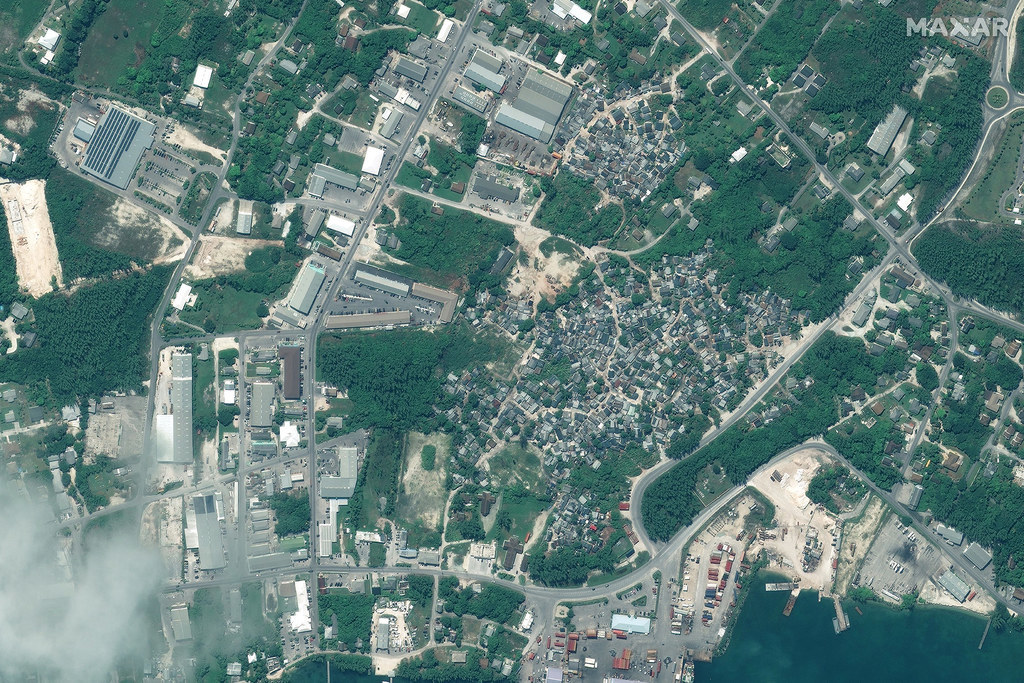
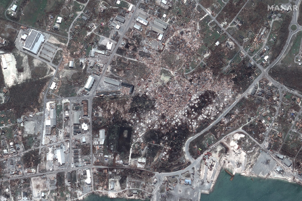
Marsh Harbour

Satellite image ©2019 Maxar Technologies. / Via http://

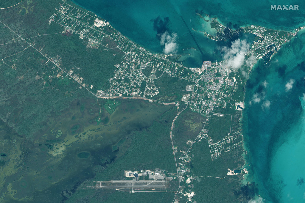
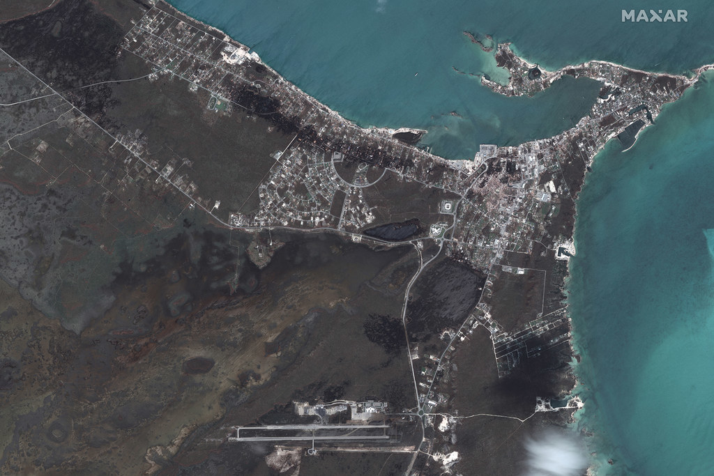
Downtown Marsh Harbour

Satellite image ©2019 Maxar Technologies. / Via http://

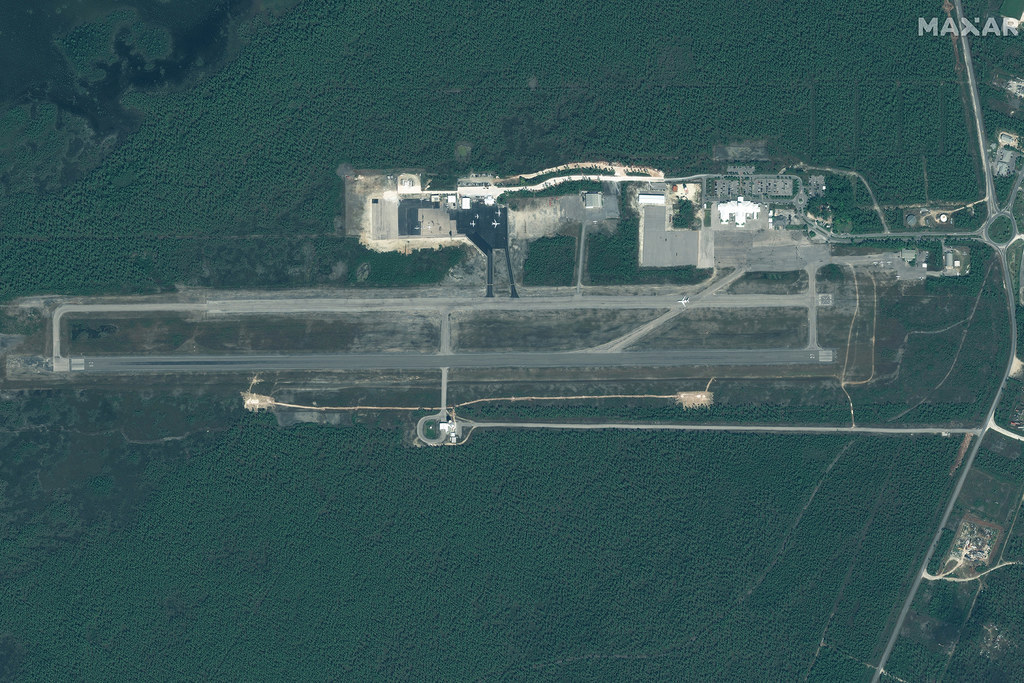
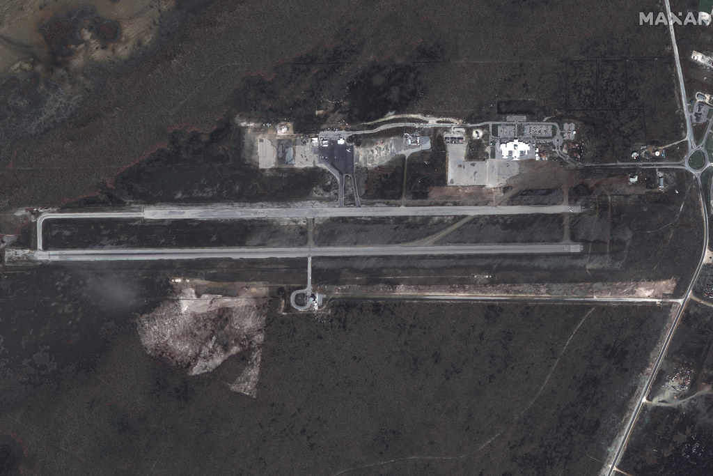
Leonard Thompson International Airport

Satellite image ©2019 Maxar Technologies. / Via http://

Marsh Harbour Marinas and Homes

Satellite image ©2019 Maxar Technologies. / Via http://

Northwestern Marsh Harbour

Satellite image ©2019 Maxar Technologies. / Via http://

Northern Marsh Harbour

Satellite image ©2019 Maxar Technologies. / Via http://

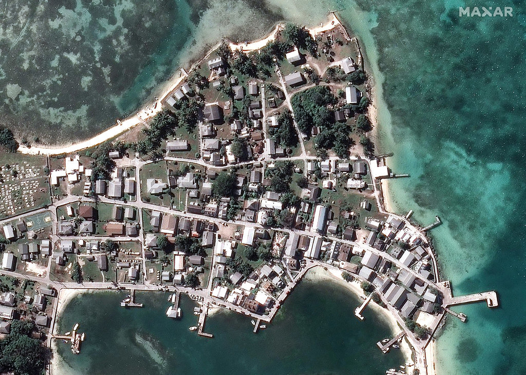
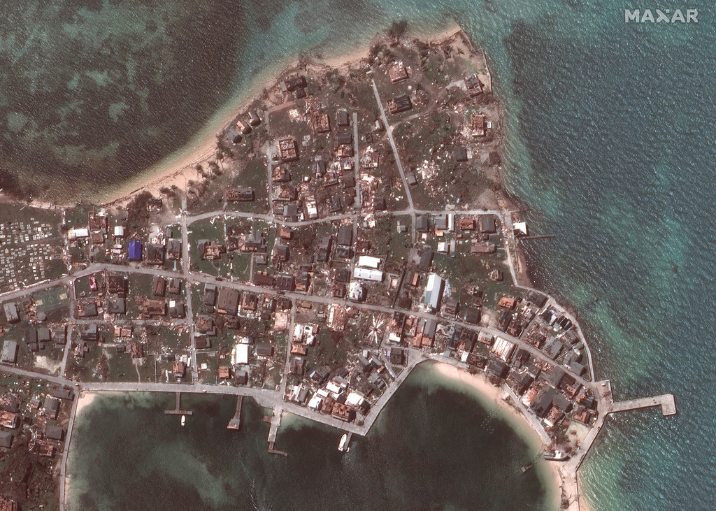
Overview of New Plymouth and Green Turtle Cay

Satellite image ©2019 Maxar Technologies. / Via http://

Close-up of Green Turtle Cay

Satellite image ©2019 Maxar Technologies. / Via http://
Skip to footer