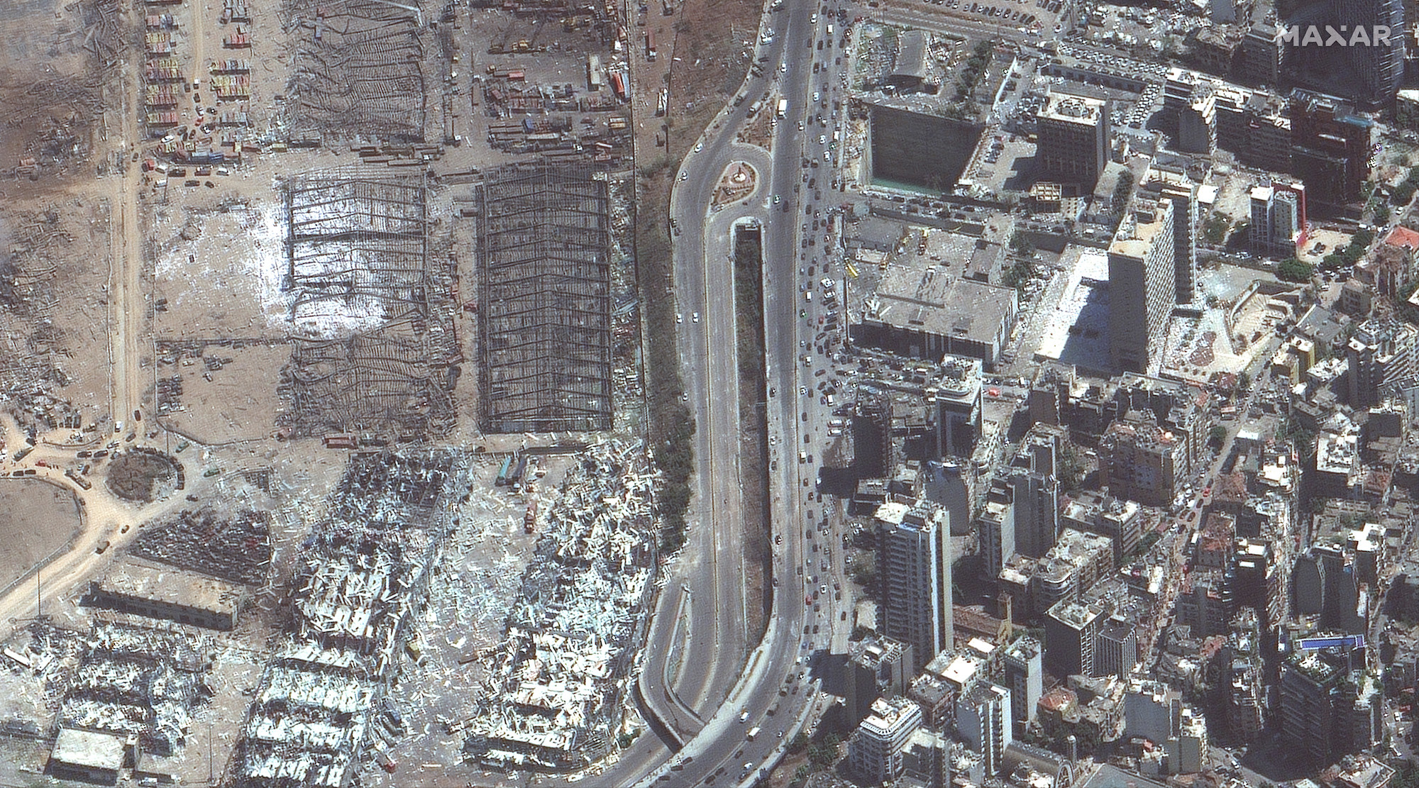
Dozens of people were killed and thousands more injured after a gigantic explosion tore through Beirut on Tuesday, pulverizing entire neighborhoods and devastating a nation facing political and economic crises, as well as the coronavirus pandemic.
Lebanese authorities have said they suspect the disaster was caused by almost 3,000 tons of ammonium nitrate being stored unsafely at a warehouse at a port in the capital city.
The force of the explosion was estimated by scientists at the University of Sheffield to be one-tenth the power of the atomic bomb dropped on Hiroshima in 1945 during World War II. It was "unquestionably one of the biggest non-nuclear explosions in history," the researchers said.
Officials have said at least 135 people died and 4,000 others were injured.
These Maxar satellite photos, some of which capture sites in Beirut before and after the blast, provide a glimpse at the monumental scale of the damage.
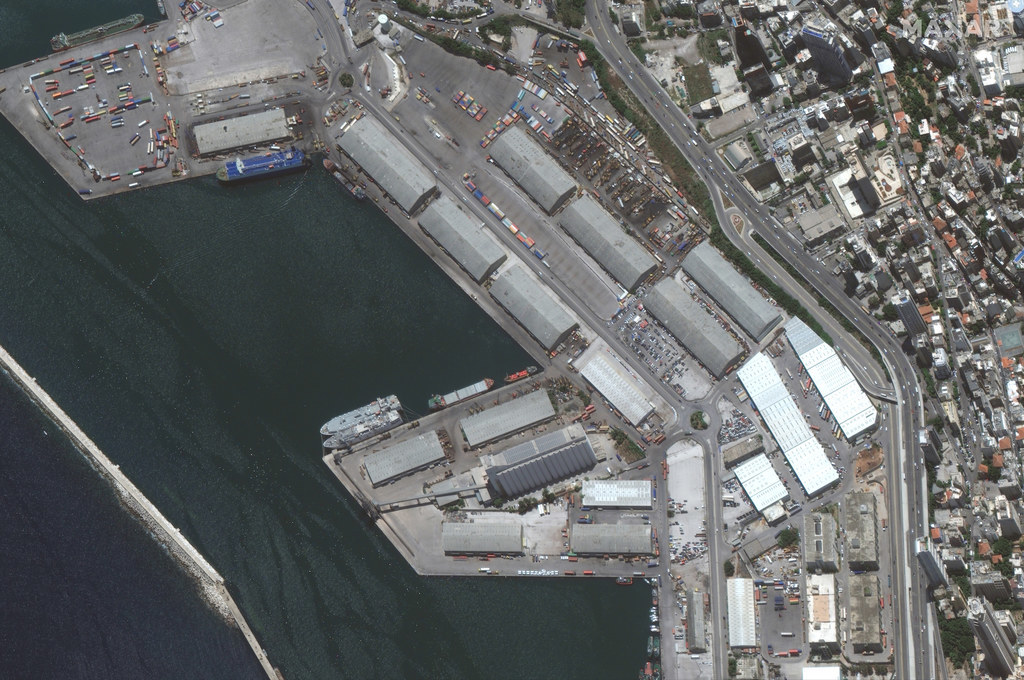
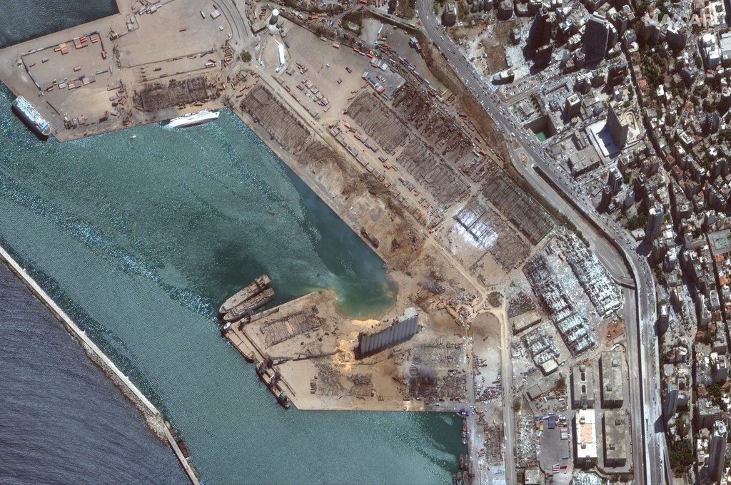
Here's the port area of Beirut on June 9, 2020, and again on Aug. 5 following the explosion:
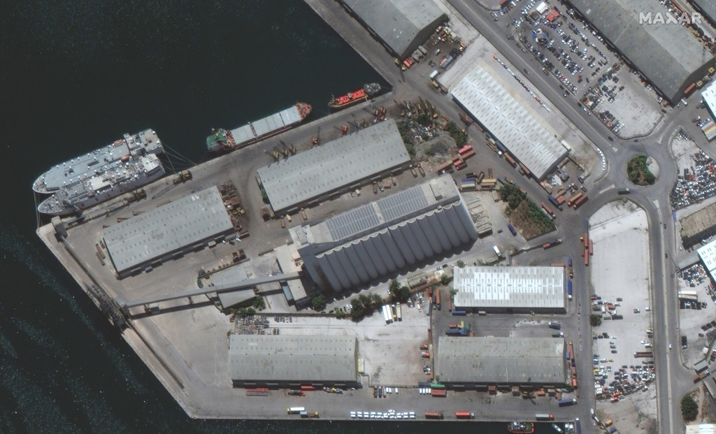
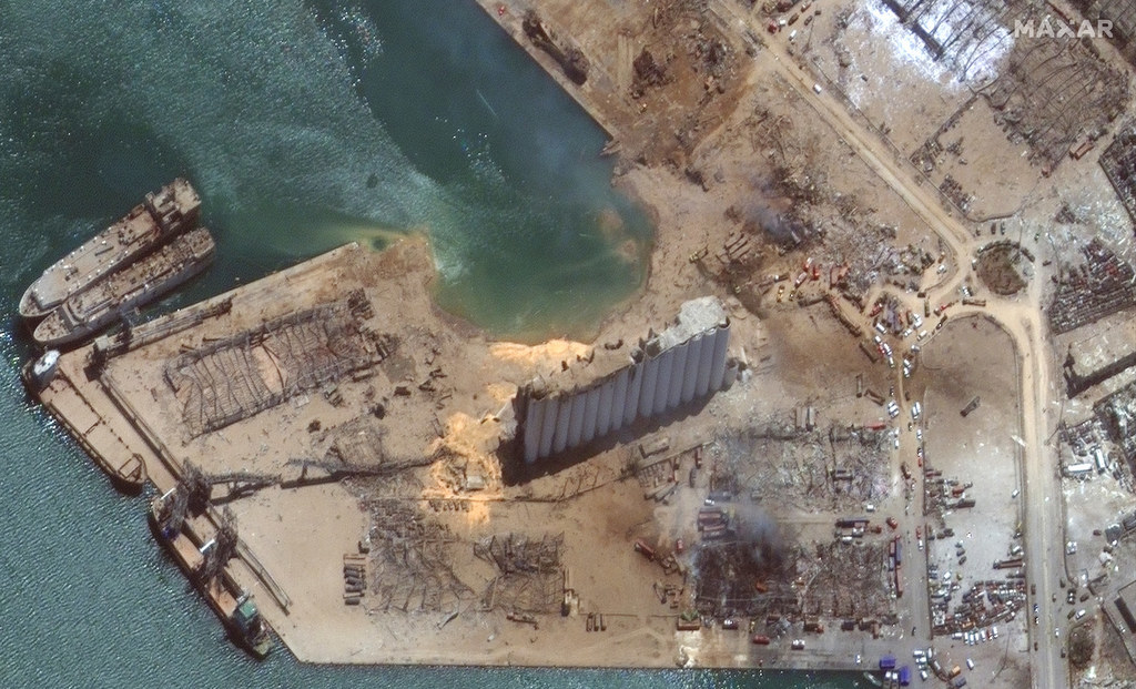
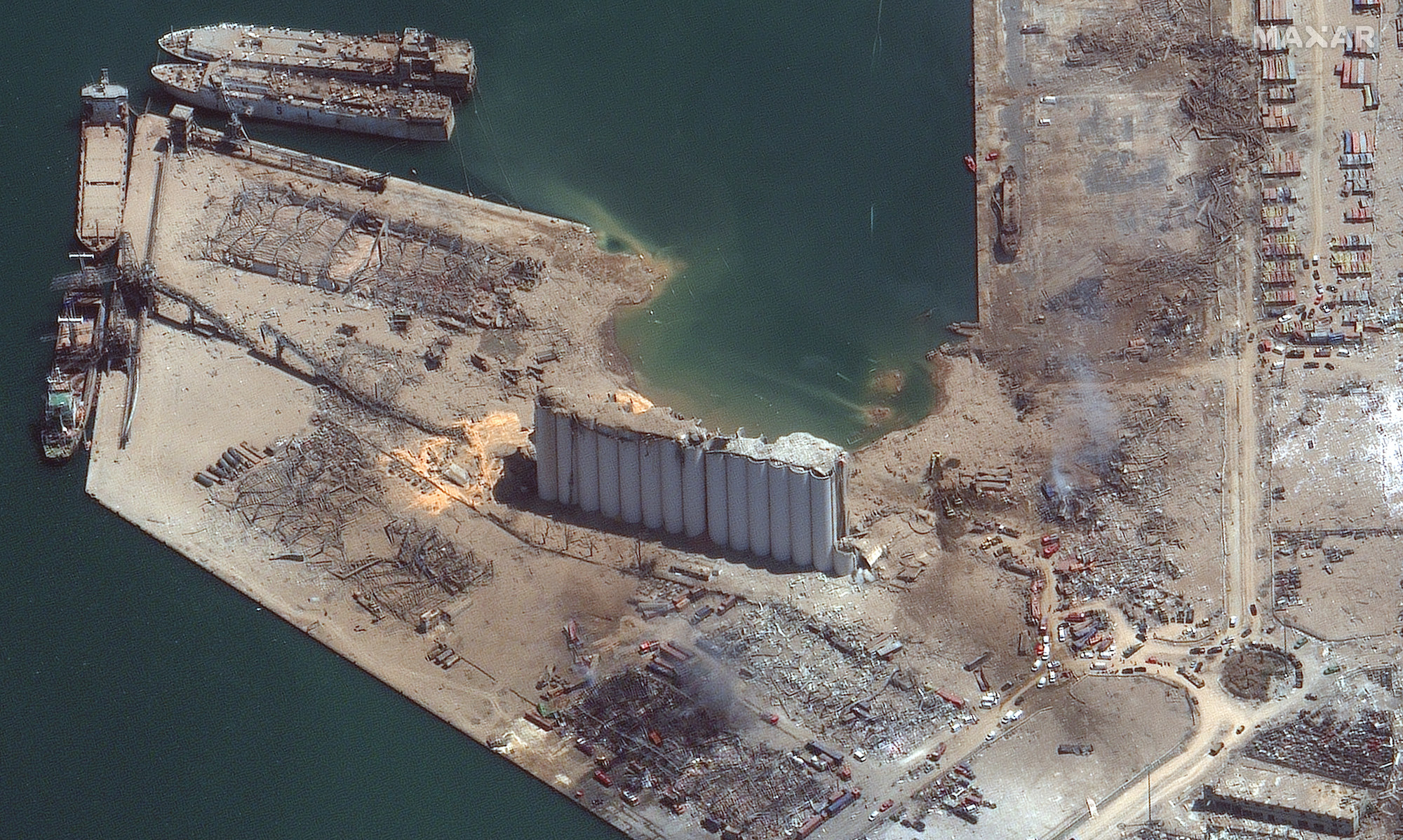
This is a close-up of the grain silo at the Beirut port on June 9, 2020, and then on Aug. 5:
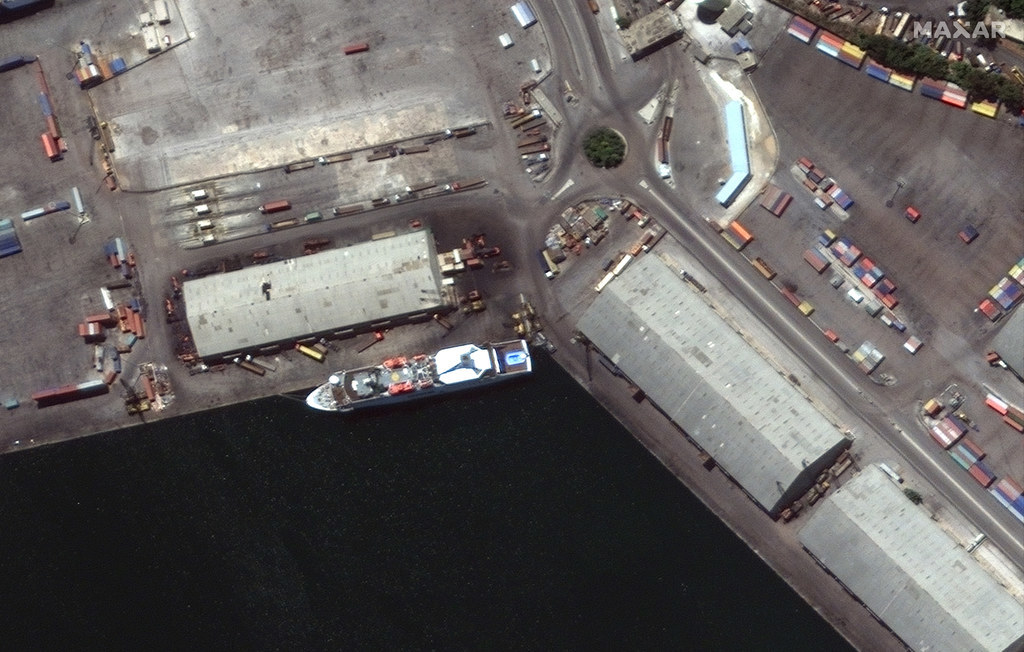
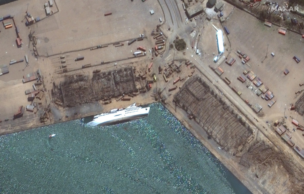
The Orient Queen cruise ship is seen docked at the Beirut port on July 31, then on Aug. 5 where it had capsized after the explosion:
Here's another view of the grain solo obliterated by the explosion:
And these are damaged buildings and warehouses in Beirut after the blast: