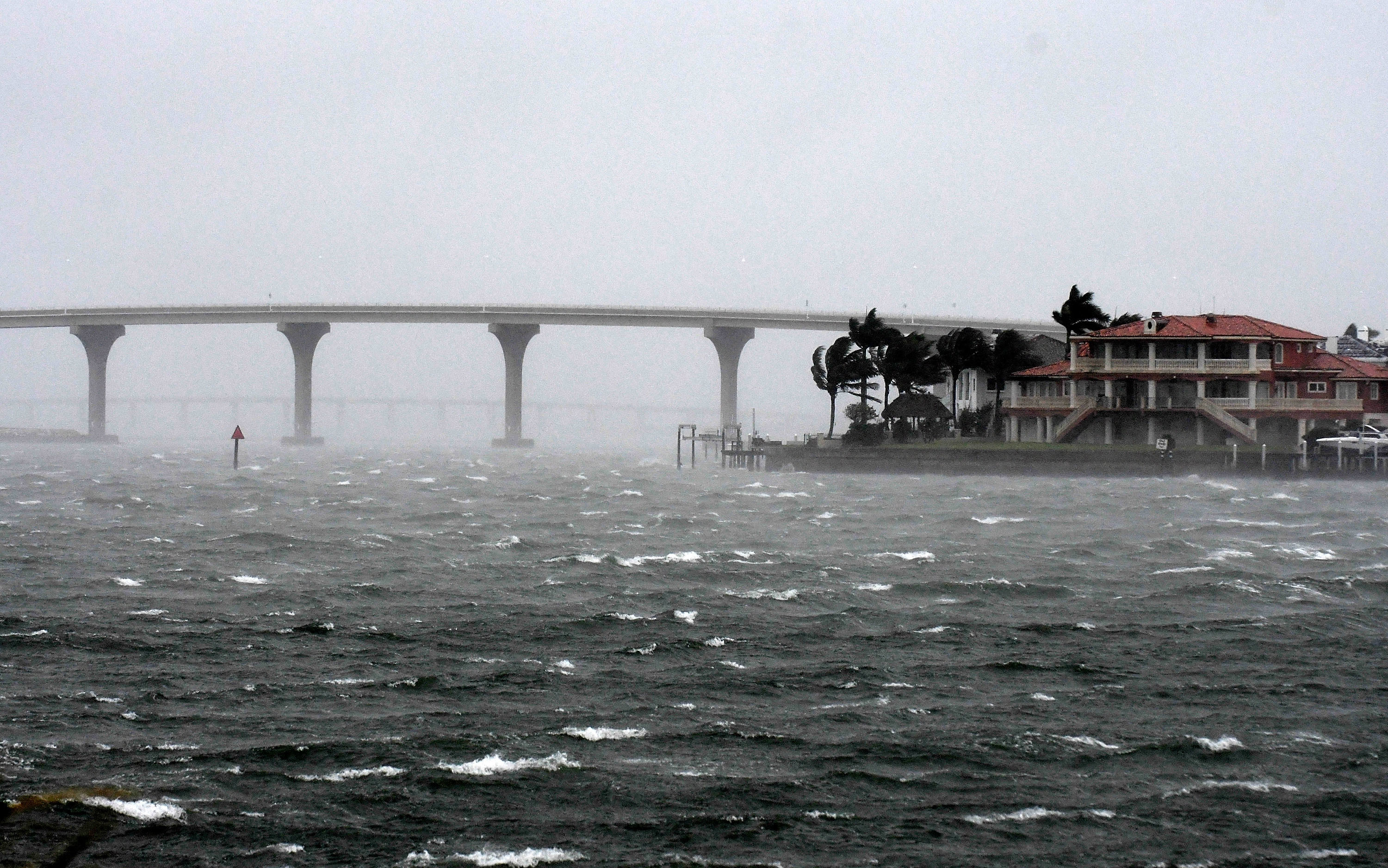
The eye of Hurricane Ian officially made landfall in southwestern Florida on Wednesday afternoon as a Category 4 hurricane, and forecasters expect it to be one of the biggest and most powerful storms to hit the state in decades.
As of 3:10 p.m. on Wednesday, the National Hurricane Center said that the eye of Hurricane Ian had made landfall along the southwestern coast of Florida near Cayo Costa around 3:05 p.m. Eastern time. The maximum sustained winds were estimated to be near 150 miles per hour.
That’s just short of the Category 5 threshold, and the agency said in a public advisory that Ian is already “causing catastrophic storm surge, winds, and flooding in the Florida peninsula.”
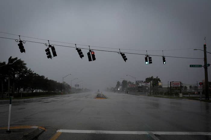
More than 2.5 million residents were under an evacuation order late on Tuesday as powerful winds pummeled the Florida peninsula. A storm of Ian's intensity could lead to heavy infrastructure damage and power outages lasting weeks or months.
At a press conference on Wednesday morning, Gov. Ron DeSantis said it was “really, really significant” that the storm had strengthened overnight as it made its way toward Florida.
“This is going to be a nasty, nasty day — two days,” he said.

*RARE* first person view of storm surge. This camera is 6 feet off the ground on Estero Blvd in Fort Myers Beach, FL. Not sure how much longer it keeps working. You’ll see it live only on @weatherchannel #Ian
A storm surge of 12 to 18 feet above ground level with destructive waves is expected along the coast of southwest Florida, according to the National Weather Service in Tampa Bay. Currently, storm surge warnings are in effect for the regions of Suwannee River, Tampa Bay, Lower Florida Keys, Flagler/Volusia County, and St. Johns River.
“Persons located within these areas should take all necessary actions to protect life and property from rising water and the potential for other dangerous conditions,” the National Hurricane Center said.
At 12:50 p.m. on Wednesday, the National Weather Service issued a flood warning for areas of Central Florida, including Orange, Volusia, Osceola, and Brevard counties.
In addition to rainfall and wind, the National Hurricane Center has warned of possible tornadoes, especially in east central Florida.

Currently in Fort Myers, Florida. Video by Loni Architects #flwx #Ian #hurricane
More than 2.6 million customers had lost power by Wednesday night, according to a power outage tracker, and hundreds of flights to and from Florida have been canceled.
US Border Patrol said Wednesday that four Cubans swam to shore on Stock Island, Florida, after a boat carrying immigrants sank during the hurricane. Another 23 people remain missing.
Three water line breaks were reported Wednesday afternoon in Manatee County. Two have been repaired, and the third will be repaired “as soon as the storm conditions improve,” the county government said in a tweet, adding that “approximately 15% of sewage lift stations are without power, so customers are asked to limit flushing.”

MAJOR storm surge Pine Island, Florida Dominator Fore Hurricane Ian eye wall
After making landfall, Ian is expected to move toward central Florida on Wednesday night and Thursday morning. On Friday, Ian is forecast to turn north toward the northeastern Florida coast before moving toward the Georgia and South Carolina coasts late Friday.
Ian first formed as a tropical storm on Sept. 23 before surging in strength. It made landfall in Cuba on Tuesday, knocking out power to the entire island, the Cuban government said.
Only a handful of storms with maximum sustained winds of more than 155 miles per hour have hit the US, including Hurricane Andrew in 1992. In the past 50 years, storm surge flooding has caused nearly half of the deaths associated with landfalling tropical cyclones, according to the National Hurricane Center.
Weather disasters are inextricably linked to human-induced climate change. The planet has already warmed 2.1 degrees Fahrenheit since 1880, according to NASA, and that’s making disasters worse. Wildfire seasons are getting longer. Hurricanes are getting wetter and more dangerous. Heat waves are getting hotter, more frequent, and longer. Heavier rainfall across the US is triggering more inland flooding. And the cost of climate disasters is soaring. Stopping this vicious cycle will require drastically reducing our reliance on climate-polluting fossil fuels.
As of 5 p.m. on Wednesday, winds had slightly decreased to 140 mph as the hurricane, but even as it continues to weaken, forecasters said it could still be near hurricane strength as it approaches northeast Florida, Georgia, and South Carolina. Tropical storm warnings and storm surge watches have been issued in some regions of North Carolina and South Carolina.
You can track Hurricane Ian on the NOAA website.